Property Record
1050 Ridgeland Pky, Alpharetta, GA 30004

NEARBY LISTINGS FOR SALE OR LEASE
Property Detail
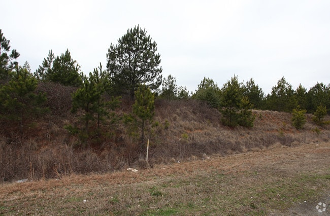
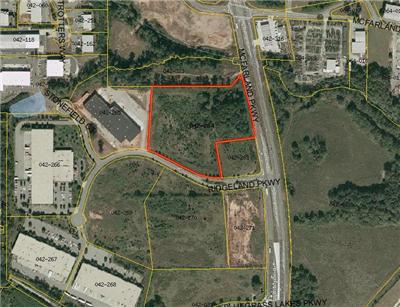
1050 Ridgeland Pky
Atlanta-Sandy Springs-Roswell, GA
Ridgeland Corporate Center
042-263
2-1 821 TR 1 RIDGELAND COR PORATE CENTER
Commercialnec
Forsyth
X
Georgia
13121C0076F
1
2024
0.88 AC
2025
N Fulton/Forsyth County
011661
Atlanta
2,514 SF
DEMOGRAPHICS near 1050 Ridgeland Pky
1 Mile
3 Mile
5 Mile
2024 Total Population
6,642
60,988
160,396
2029 Population
7,857
67,952
175,655
Pop Growth 2024-2029
+ 18.29%
+ 11.42%
+ 9.51%
Average Age
37
37
38
2024 Total Households
2,516
21,461
54,826
HH Growth 2024-2029
+ 18.68%
+ 11.18%
+ 9.33%
Median Household Inc
$129,852
$122,658
$137,165
Avg Household Size
2.60
2.80
2.90
2024 Avg HH Vehicles
2.00
2.00
2.00
Median Home Value
$433,464
$465,981
$481,244
Median Year Built
2010
2003
1999
Nearby Places
Map Layers
Map Styles
 Street
 Aerial
- Restaurants
- Banks
- Shops
- Fitness
- Groceries
SALE & LEASE HISTORY
LISTING DATE
SALE/LEASE

Sep 24, 2016
For Sale
Nov 22, 2021
For Sale
Nearby Properties
Address
Land Use
TOTAL SIZE
Lot Size
Zoning
Address
Land Use
TOTAL SIZE
Lot Size
Zoning
4,519,676 SF
29 AC
AC
Address
Land Use
TOTAL SIZE
Lot Size
Zoning
5,168,439 SF
45 AC
AC
Address
Land Use
TOTAL SIZE
Lot Size
Zoning
3,966,282 SF
25.68 AC
R4
Address
Land Use
TOTAL SIZE
Lot Size
Zoning
2,308,770 SF
32 AC
C1C
Address
Land Use
TOTAL SIZE
Lot Size
Zoning
56,313 SF
13.37 AC
MP
Address
Land Use
TOTAL SIZE
Lot Size
Zoning
3,363,714 SF
19.89 AC
TRCON
Address
Land Use
TOTAL SIZE
Lot Size
Zoning
550,076 SF
45.25 AC
OIC
Address
Land Use
TOTAL SIZE
Lot Size
Zoning
396,000 SF
43.42 AC
C1
Address
Land Use
TOTAL SIZE
Lot Size
Zoning
216,794 SF
6.66 AC
OI
Address
Land Use
TOTAL SIZE
Lot Size
Zoning
90,671 SF
11.03 AC
MP
Address
Land Use
TOTAL SIZE
Lot Size
Zoning
64.48 AC
AG1
Address
Land Use
TOTAL SIZE
Lot Size
Zoning
279,125 SF
18.55 AC
OI
Address
Land Use
TOTAL SIZE
Lot Size
Zoning
1,121,442 SF
13 AC
A0
Address
Land Use
TOTAL SIZE
Lot Size
Zoning
1,144 SF
35 AC
AG1
Address
Land Use
TOTAL SIZE
Lot Size
Zoning
103,825 SF
14.46 AC
C1
Address
Land Use
TOTAL SIZE
Lot Size
Zoning
152,200 SF
17.38 AC
C1
Address
Land Use
TOTAL SIZE
Lot Size
Zoning
96,999 SF
10.93 AC
CBD
Address
Land Use
TOTAL SIZE
Lot Size
Zoning
91,585 SF
8.77 AC
C1
Address
Land Use
TOTAL SIZE
Lot Size
Zoning
125,181 SF
10.95 AC
C2
Address
Land Use
TOTAL SIZE
Lot Size
Zoning
37.61 AC
AG1
Address
Land Use
TOTAL SIZE
Lot Size
Zoning
27.50 AC
AG1
Address
Land Use
TOTAL SIZE
Lot Size
Zoning
73,120 SF
1.22 AC
AG1
Address
Land Use
TOTAL SIZE
Lot Size
Zoning
202,466 SF
22.85 AC
C1C
Address
Land Use
TOTAL SIZE
Lot Size
Zoning
6.07 AC
MP
Address
Land Use
TOTAL SIZE
Lot Size
Zoning
137,848 SF
9.51 AC
OIC
Address
Land Use
TOTAL SIZE
Lot Size
Zoning
182,470 SF
14.24 AC
C1
Address
Land Use
TOTAL SIZE
Lot Size
Zoning
138,941 SF
26.40 AC
RES3
Address
Land Use
TOTAL SIZE
Lot Size
Zoning
82,035 SF
12.32 AC
C1
Address
Land Use
TOTAL SIZE
Lot Size
Zoning
151,980 SF
8.77 AC
M1
Address
Land Use
TOTAL SIZE
Lot Size
Zoning
142,145 SF
17.47 AC
OI
The World's #1 Commercial Real Estate Marketplace
Connect with us
© 2026 CoStar Group
The information above has been obtained from sources believed reliable. While we do not doubt its accuracy we have not verified it and make no guarantee, warranty or representation about it. It is your responsibility to independently confirm its accuracy and completeness. Any projections, opinions, assumptions, or estimates used are for example only and do not represent the current or future performance of the property. The value of this transaction to you depends on tax and other factors which should be evaluated by your tax, financial, and legal advisors. You and your advisors should conduct a careful, independent investigation of the property to determine to your satisfaction the suitability of the property for your needs.